Walk a mile in my shoes
I’ll let you in on a little secret; I loath walking. Yep, that’s right. Lace me up in a pair of trainers, and I’ll happily blaze the trail on a mountain run, go speed hiking for hours, heck, you can even convince me to go nordic walking with you. But walking to the shops and back, Nah, no thanks. So when I heard about an organised 130km “walk” called the Via Degli Dei (Italian for “walk of the gods”), a trail that connects the Piazza Maggiore in Bologna with the Piazza della Signoria in Florence, what piqued my interest? Swap the word walk for a hike, and I’m in! It did sound far, though…
From start to finish and somewhere in between…
With its 40 km of arcades, Bologna is unquestionably a beautiful place to kick off a hike, and Florence? Albeit for me to say no to crossing the finish line there. Fun fact: Florence is also a UNESCO heritage site. At the heart of the hike are the Tuscan-Emilian Apennine mountains and the “Flaminia military,” a road built in 187 BC by the Romans. This historical Via Degli Dei trail is inspired by the connection between the two cities and everything in between. Big boots to fill!
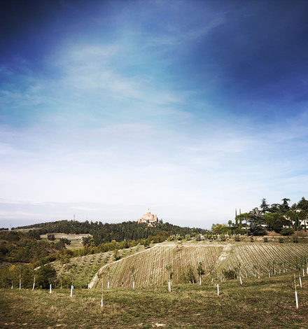
Leaving Bologna with Saint Luca cathedral in the distance | Image credit Chrissy Gassner
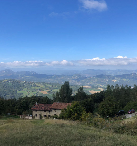
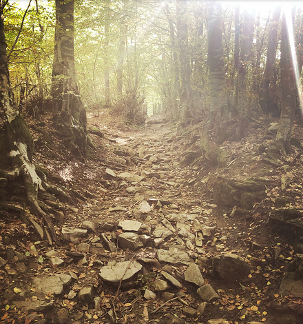
Typical scenery on the via degli dei hike | Image credits: Chrissy Gassner
Day 1: Bologna – Sasso Marconi: Food glorious food
Walking distance: 21.3 km
Difference in altitude: +104 m; -33 m
Time: 7. 20h
Getting out of Bologna was not easy – in short, there are too many great cafes with endless offerings of pastries and espresso! Once we had our sufficient sugar fix, we finally bid farewell to this vibe city. We commence our hike from San Luca cathedral (even though the Piazza Maggiore is the official starting point, we had seen it the day before, no need to walk unnecessary miles, we say) situated approx 5km out of Bologna, with a bird’s eye view of the city. From here, the trail leads through Talon Park, a beautiful wooded forest, then meanders for what seems like hours (and undoubtedly was) down to the banks of the Reno river, where the first signs of the Via Degli Dei greet us! Our first night was spent in the most divine B&B farm stay run by a Mother (90 years old!) daughter team who, for 15€ extra, served us farm-to-table meals that included homemade pasta, “maiale al forno” (roasted pig also from their farm) and a bottle of local Chianti – sure glad we left Bologna when we did!
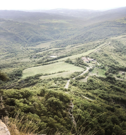
The view from Monte Adone. || Image credit: Chrissy Gassner
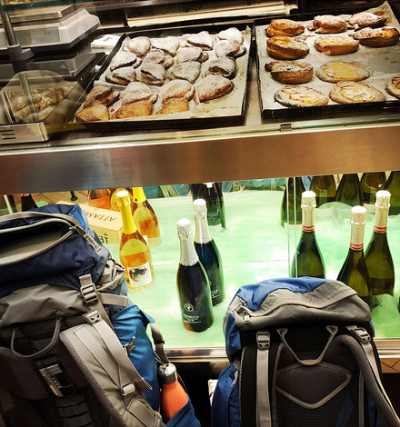
Culinary delights and hiking – what a combo. | Image Credits Chrissy Gassner
Day 2: Sasso Marconi- Brento – Monzuno – Lodole: Addictive
Walking distance: 21 km
Difference in altitude: +602 m; -109 m
Time: 7.50 h
Today felt like we were proper hikers! We had left any trace of urban life behind us and spent the day blissfully on beautiful Emilia Romagna forest trails. Quiet was the day’s word; even the birdlife seemed to meditate in these forests!
My hiking buddy Chrissy and I live in a kitsch Bavarian village at the foothills of the German Alps, so it feels like second nature to climb a mountain peak. So we were pumped for our first proper mountain peak today, Monte Adone. It sure didn’t disappoint and was a great vantage point to enjoy (more) silence and the beautiful panorama.
Another gem of a farm stay, tonight we were pretty knackered, so the host ordered us a pizza from a local trattoria (trust me, takeaway pizza in Italy takes on a whole new meaning). Italians don’t emphasise breakfast – it’s more of a stand-up affair with a good dose of conversation, espresso in one hand and a pastry in the other, not quite the fuel you need when there’s a day of hiking ahead. So you can imagine how excited we were when breakfast consisted of fresh fruits, boiled eggs, freshly baked bread, and scrumptious coffee the following day. I could seriously become a B&B addict if they remain at this level!
Day 3: Lodole – Madonna dei Fornelli – Passo della Futa: Boarders
Walking distance: 23.5 km
Difference in altitude: +922 m; -639 m
Time: 7.50 h
Today we crossed the border from Emilia-Romagna over into Tuscany! For us, that meant one thing: New culinary delights! Did I mention that this “walk” (which, by the way, I have come to realise should not have been underestimated, it IS a proper hike) was so attractive to me because of the regional specialties that beckon along the way? No disappointment so far. Anyway, back to the trail… today saw us hiking through a forest of chestnut trees and glimpsing the first tell-tale signs of a golden Tuscany autumn. It also gave us a humble display of ancient history with stretches of the Roman “Flaminia Militare” route, dating back to 187 BC, as well as ancient kilns presumably dated to the 2nd century BC. that accompanied us on different sections of this stage.
The Flaminia Militare road dating back to 187 BC. | Image credits: Chrissy Gassner
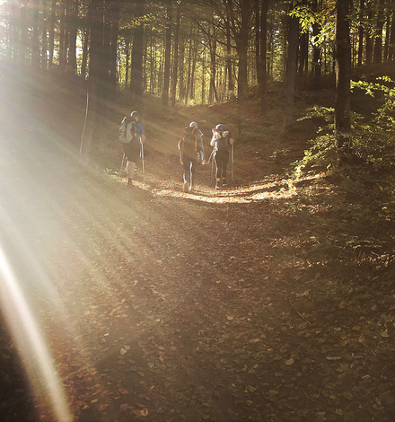
Keep walking, they said…| Image credits: Chrissy Gassner
One of the best things about hiking in Italy is the Italians. But a word of warning: if you’re not a communicative person, then you may have a problem. It all starts with an innocent greeting. You’re walking through a picturesque Tuscan village picking local grapes off the vine when the first head pops over a fence, “Buongiorno!” and that’s all it takes. You may get away with just a greeting if you have rudimentary Italian as I do. However, my companion Chrissy is versed in the language, and our wonderful Italian hiking partner Tiziana whom we have met along the way, is as communicative as the rest of the country, suggesting “Buongiorno” to her, opens up to a plethora of conversations that indicate it’s usually time to pull up a side of the road, have a snack and rest the feet because we are in for the long haul.
Day 4: Passo della Futa – Sant’Agata: Lost amongst the wolves
Walking distance: 23.5 km
Difference in altitude: +922 m; -639 m
Time: 7.50 h
Today we got lost, and it’s also the highest elevation point of the Via Degli Dei hike over the Apennine mountain range. It’s day 4, and we are all feeling in “the flow”. For me personally, it felt like I could continue like this for months – keep walking all the way to Assisi, Rome even, grow a beard, you get the picture. It was a day spent entirely in a national park; hours devoted talking to each other or walking with our own thoughts, all very meditative – until we got hungry. With no town or village in sight, we could not stock up on our provisions. According to our guidebook, however, we were enlightened that around the 5-hour walking mark, we would come across “Osteria Bruciata“. Here, we imagined ourselves sitting back, drinking our daily espresso ritual, and eating a giant, fat panini. So when we excitedly arrived at “Osteria Bruciata,” you can imagine our dismay when the restaurant closed its doors in… the 1600s. “Osteria Bruciata” – mmm, may not have wanted to eat there anyway – legend has it that the restaurant’s proprietor robbed and killed his overnight guests and served them up on the next day’s blackboard menu.
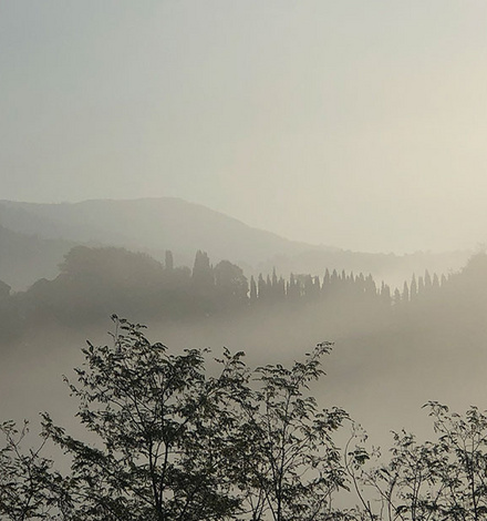
Wolf country! Apennine ranges Ital. | Image credit: Chrissy Gassner
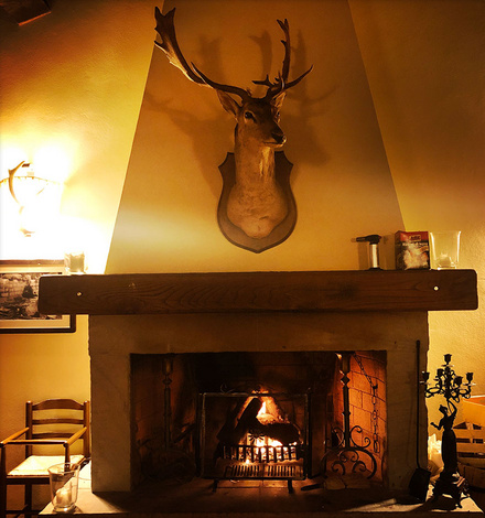
Italian hospitality in the mountains. | Photo credit: Chrissy Gassner
So on we marched, hungry and still lost. Word of advice: If possible, try to find accommodation close to the trail. 2 km doesn’t SOUND like a lot, and on a map, it doesn’t LOOK far, but when you’ve been walking all day and then you have to go a few kilometers out of your way for lodgings, believe me, your feet will say it IS far. Finally, our B&B was a welcoming sight amidst the Apennine mountains, with signage warnings that this was wolf territory!
Day 5: Sant’Agata – Bivigliano/ Noi siamo Warriors
Walking distance: 20.7 km
Difference in altitude: +417 m; -167 m
Time: 7.50 h
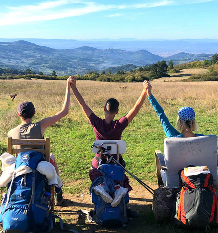
Amazing how a regenerative night’s sleep can boost morale and make you get out of bed for the 5th day in a row of hiking! Today felt like our recovery day. The walking seemed easy – or were we getting stronger? After surviving yesterday’s hardships, we named our trio (with Tiziana joining us) “Noi siamo warriors” (Italian for “we are warriors”) mainly because we all do yoga, but still.
First sights of Florence in the distance today and awareness that this beautiful experience was rapidly approaching a wrap. One highlight I emphatically loved about this adventure was the comradery evident on the Via Degli Dei trail with all the other hikers. Some days you would have a coffee and chat at a little cafe before the walk commenced or at the day’s destination; most of the hikers would eat in the same trattoria or stay at the same B&B where we would all share our war stories of the day.
Day 6: Bivigliano – Florence/ mission complete
Walking distance: 18.5 km
Difference in altitude: +14 m; -549 m
Time: 4.50 h
We knew it was coming but today was the end of the trail. That is, technically, it was. Chrissy and I quickly shuffled plans when we discovered a gorgeous camping ground (with a swimming pool!) in Fiesole, a mere 8 km away from Florence and our final destination. Neither of us was ready to face the calamity of city noises just yet; henceforth, our decision to have a “holiday”, stay put by the swimming pool saluting the views of Florence with a Campari in hand, and finish the hike a day later than planned. Tiziana, the warrior she is, was not to be deterred by an Aperol spritz and a refreshing dip in the water, so she, carrying the flag of a true hiker, continued. For now, we were satisfied with the glorious views of Florence – poolside.
Because the Via Degli Dei hike was initially calculated to be completed within 6 days and by all means achievable, I won’t enter an extra day. Tiziana returned from Florence that night, and we were unprepared for her emotions. Would we also feel like that when tomorrow came?
Nearly at the via degli dei’s final destination – Florence. | Image credit: Chrissy Gassner
Warning! Warriors on the trail. | Image credit: Chrissy Gassner
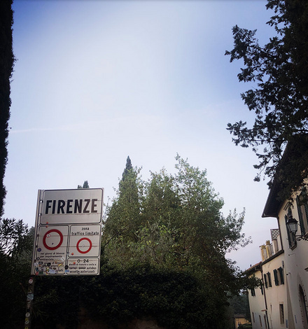
The following morning we were up at 5 am and out of the campsite by 5:30 am, still dark and with the lights of Florence beckoning! At 9 am, we arrived at the hike’s final destination – Piazza della Signoria in Florence and were again surprised at how emotionally overwhelmed we were. Approx. 130 km (give or take a few clicks with getting lost and finding accommodation), we had completed the Via Degli Dei!
Packing List
What came in useful:
- Rain Jacket/Hardshell: even if it doesn’t actually rain, mornings in the mountains are usually chilly, and a good hardshell jacket keeps the cold at bay.
- Merino wool apparel: one long sleeve and one short sleeve seemed to suffice. Even without clothes washing for 6 days, there were no smellies, and they dried quickly.
- Double-Layered hiking socks: mine were from Wrightsock, and I can highly recommend
- Compression anti-fatigue socks: yes, there is such a thing, and they work. Mine were from CEP; I also wear them for running
- First -Aid-Kit
- Magnesium (was a blessing for cramps)
- Sunscreen – lots!
- Sunhat: We were wearing caps, but a lot of hikers were wearing those nerdy (hipster?) hiking hats with a broad brim
- Hydration Bladder: I’m on the fence with this one. It’s an indispensable piece of gear for hydrating whilst cycling; however, 6 days of biting and sucking on a tube were exhausting, and I think it could promote above-the-lip wrinkles help!
What we should have packed:
- Compass
- Powerbank (if you are using mobile apps a lot)
- Topo map (we relied too much on mobile apps)
- Headlamp